Product Review – Maps Unique
The development of Maps Unique began as a concept in 1988 to assemble information on prime offshore habitats along the southeastern United States. Chip Berry’s fishing buddies were always coming around wanting to peek at and get copies made of his ongoing data assembly, which many referred to as the “unique maps.” Thus, “Maps Unique” was born.
Maps Unique (the printed maps) and Nav-Unique (an SD card to upload directly into your GPS) have compiled live bottom data from a variety of resources through the years, including government studies/research, onsite interpretations, and especially from interviews/feedback from fishing clients, including commercial interests, through the years.
Six versions of the printed maps and SD cards are available, including (1) Hatteras/Cape Lookout, (2) Cape Lookout/Cape Fear, (3) Cape Fear/Murrells Inlet, (4) Murrells Inlet/Charleston, (5) Charleston/Beaufort, SC, and (6) Beaufort, SC/Savannah, GA.
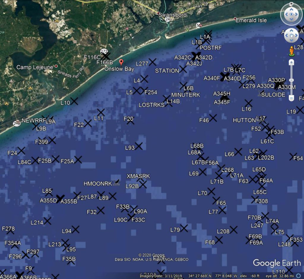
The fishing and design features include detailed maps depicting prime offshore fishing habitats from over 30 years of research and knowledge that geographically map in great detail the seafloor topography, natural hard-bottom habitats, artificial reefs, wrecks, and Marine Protected Areas (MPAs).
In addition, all habitat sites are named, numbered with coordinates, and listed with water depth and structure type with descriptions.
Each Maps Unique is printed with two back-to back adjacent regions (for example, Cape Lookout on one side and Cape Fear on the other side). The maps are heavy-seal laminated for durability and are folded into three panels for easy use and storage offshore.
The Nav-Unique is supplied on a Mini SD card, with a standard SD card adaptor also included. Simply insert the Nav-Unique SD card in the GPS unit and click the function to upload data on your GPS. The card is already formatted for most all GPS units/models, including Garmin, Furuno, Simrad, Raymarine, Hummingbird, C-Map, and others.
Updated to 2021, each SD card comes with two large geographic areas, the same as the hardcopy printed map areas.
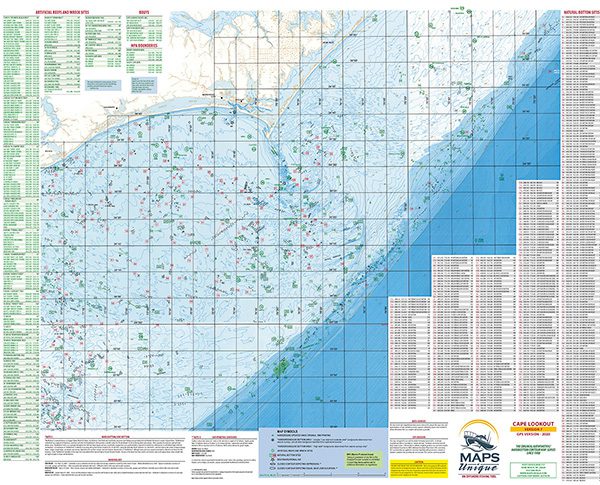
Chart plotters will display waypoints, special Maps Unique icons matching the hardcopy map sites, and many place names. Each region literally has 1000 unique waypoints, so it is likely that you’ll never manually import another site again.
For both products, the printed maps and the SD cards, the Maps Unique website includes tips on using contours and hardbottom plots effectively for finding and fishing bottom structure, and understanding and fishing everything from the Gulf Stream to nearshore water pockets and edges just off the beach.
Maps Unique and Nav-Unique are available in retail stores up and down the east coast, or you can find out more information and/or order online at www.mapsunique.com.